

This story is the 23rd in our series on the hidden history of Vancouver’s neighbourhoods. Read more.
“Be bold or move to suburbia,” was the challenge from condo marketer Bob Rennie when units in the Woodward’s development went up for sale in 2006. Located in the shell of an iconic department store, the project heralded a new inflection point in the city’s treatment of the issues of homelessness, addiction, and poverty in the Downtown Eastside (DTES) by promising social housing alongside its market-rate condos. Money had poured into support services; now it was time for an influx of “bold” gentrifiers to raise the tide for the city’s marginalized. Fancy restaurants like Pidgin, across the street from the area’s unofficial town square, Pigeon Park, and socially conscious hipster diners like a revamped Save On Meats, arrived soon afterward to consternation and protests.
According to the City of Vancouver, the DTES officially belongs to Strathcona, but the neighbourhood itself carries too much psychic weight not to discuss on its own. (On a map from John Mikhail Asfour and Elee Kraljii Gardiner’s V6A: Writing From Vancouver’s Downtown Eastside, an anthology of work from “the poorest postal code in Canada,” the Downtown Eastside is bordered by Clark Drive to the east, Gastown to the west, the waterfront to the north, and Chinatown to the south.) Unlike the broader discussion of the area’s problems, the book highlights its storied history, its heyday as the city’s business and shopping centre, its diversity, its high density of artists: its multidimensionality.
The history of the area, the site of an Indigenous seasonal settlement in what the Stó:lō Nation calls S’ólh Téméxw (“our land” or “our world”), precedes Vancouver’s incorporation as a city in 1886. With the arrival of Europeans in the mid-19th century, settlement focused on resource extraction: present-day Gore Avenue follows the angular path formed by timber dragged to be processed at the Hastings Mill, although it was Hastings Street that would later earn the nickname “Skid Road.” The stretch of Burrard Inlet to the north end was a shipping hub and, farther west, the site of the CPR terminus.
Although Vancouver first formed in present-day Gastown, the saloon-dominated area became a less appropriate place to visit, and Vancouverites looked a few blocks south. St James’ Anglican Church was built on its current site at the corner of Gore Street and East Cordova in 1881, followed by a hospital at the corner of Cambie and Pender Street in 1888. The well-heeled lived on Alexander Street, and the new businesses of the area became the heart of the city. By the end of the 1890s, there were 60 hotels to serve travellers passing through the growing city of 20,000 people. At that point, the city, which then only extended to West 16th Avenue, had a different topography, with False Creek stretching east to Clark Drive and north to Carrall and Pender Streets. It narrowed at Main Street (originally known as Westminster Avenue), where a bridge was built. The eastern part of the inlet was filled in by the Canadian North Railway during the First World War.
By the first decade of the 20th century, the downtown core developed around Hastings and Main, two blocks east of the tram lines that brought commuters from New Westminster. They shopped at Woodward’s (opened in 1903), watched vaudeville at the Pantages Theatre, dined (complexion permitting) at the White Lunch, and borrowed books from the Carnegie Library—which opened in 1903 with a $50,000 donation from industrialist Andrew Carnegie. Freemason documents (Carnegie was a member of the society) were laid in its cornerstone. Until it settled in its present location in Mount Pleasant, city hall had various locations around the DTES—including its first incarnation as a tent, shortly after the Great Fire of 1886, at the base of Main Street.
Many buildings in the neighbourhood remain from Vancouver’s first decades, including the Carnegie. Another survivor is the city’s oldest brick building. Currently a recording studio owned by Bryan Adams, the Oppenheimer Building at 102 Powell Street was built in 1886 for wholesale grocers, the Oppenheimer brothers.
A founder of BC Electric (the precursor to BC Hydro) and the city’s second mayor, the German-born David Oppenheimer is now best known for being the namesake of the city’s oldest surviving city park—the site of antipoverty demonstrations during the Depression era that established the neighbourhood’s tradition for protest, baseball practices for the Asahi, and the annual Powell Street Festival—in the city’s historic area for Japanese immigrants, who first came to Canada in 1870s.
Despite a 1907 racist riot that it bravely fought back, the community hosted parades and built a grand arch that faced Main Street. It flourished to include hundreds of businesses and organizations—including sushi houses, a Japanese-language school, and a Buddhist temple—until the Canadian government forced its 8,000 residents into detention camps during the Second World War.
“It was said to be the cleanest spot in the city,” former resident George Nitta recalled in Daphne Marlatt and Carole Itter’s oral history, Opening Doors: Vancouver’s East End. “They got up early, the old-time Japanese, they’d get up at seven o’clock, and the first thing they’d do is sweep and even wash the street. Talk about clean! After the war, Powell Street was nothing but a ghost town.” A walking tour of the area will take visitors to the art deco-style building at 365 Powell Street, where the Maikawa Department Store opened in 1908, and 487 Alexander Street, where the Vancouver Japanese Language School was established in 1906 and still stands. The area, later rezoned exclusively for industrial use, has never fully recovered.
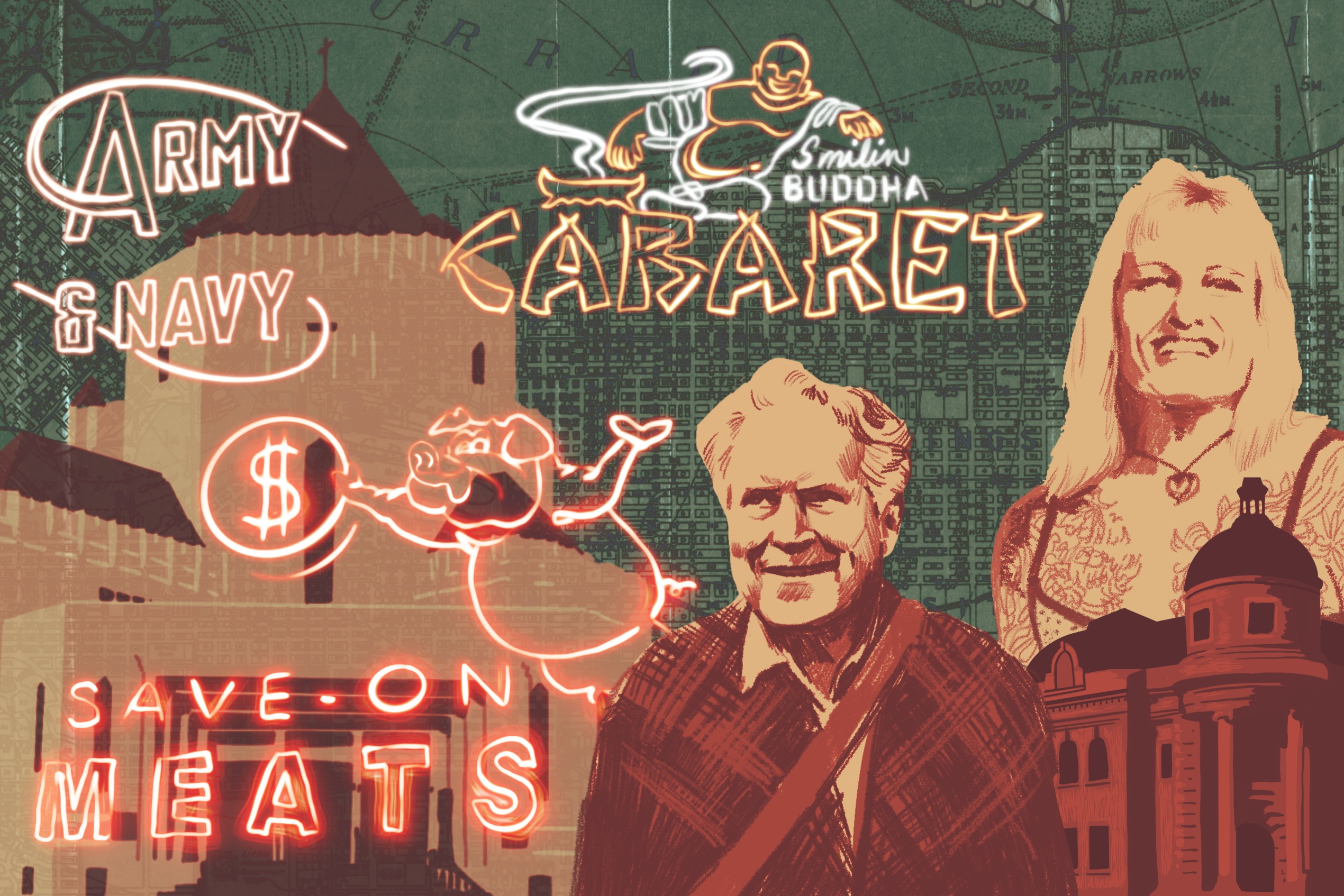
As a whole, the DTES began a downturn precipitated by the Great Depression, which affected the working class living around the port and its surrounding warehouses. With the emergence of trucks for shipping goods after the Second World War, warehouses in the area relocated to the outskirts of the city. As the city centre migrated west, so did middle-class families. (Alexander Street became a red-light district where, in 1912, police arrested 300 “keepers” and “inmates” of bawdy houses.) Amenities including city hall, the central library, and the courthouse were moved to other parts of town. The streetcars stopped running in 1958, and the North Vancouver ferry discontinued service the same year. A more transient population, some toiling in industries such as lumber and fishing, rolled into the neon-drenched area, living in its single-room occupancy hotels and drinking in “bottle clubs” like the Smilin’ Buddha Cabaret, where only mixers were supplied, to complement the hard liquor brought in brown paper bags by clientele.
In his novel Dead Man’s Ticket, Peter Trower, a former logger, offers this panoramic description of the the neighbourhood at this time: “knots of carousing loggers lurching noisily from bar to bar; shabbily dressed East End housewives looking for bargains at the Army and Navy or the Save-On Meats store; scrofulous winos with grimy paws cadging dimes in raspy voices; cut-rate hookers wearily heading for toast and black coffee at some greasy spoon cafe; a furtive heroin pusher bound for the Broadway Hotel … to set up shop at a dim beer parlour table…”
This transitional period in the neighbourhood’s history was also captured by street photographer Fred Herzog. A seaman from Germany who later found work in medical photography, Herzog spent his spare time capturing city life with his Leica. Some of those photos, first exhibited half a century after they were taken, show Hastings Street crowded with street traffic underneath a mass of neon signs, which Herzog once described “as one of the greatest use of technology, to make people happy “
As heroin and crack cocaine spread through the streets, the DTES continued to draw in the poor and marginalized even as it became increasingly unsafe for them. In the 1980s, patients with mental health diagnoses at Coquitlam’s Riverview Hospital were released without adequate support, many ending up in the DTES. The world’s fair, Expo 86, forced many residents from their homes in hotels to make room for visitors. Protestors at a public forum to discuss these evictions pelted eggs at Expo chair and local billionaire Jimmy Pattison.
Between 1978 and 2001, 65 of the neighbourhood’s survival sex workers, most of whom were Indigenous, disappeared from its streets. Their absence went largely unnoticed outside of their families, many of whom, in 1992, launched the Women’s Memorial March, now held annually on Valentine’s Day. Many of those missing women have been linked to serial killer Robert “Willie” Pickton, who was ultimately convicted of six counts of second-degree murder in 2007.
“How do you / run away in six-inch stilettos, / throw a punch without falling off your heels, / or take a beating, / without losing your wig and spilling blood on your outfit?” Antonette Rea writes in her poem “High-track, Low-track” in V6A.
Under Mayor Philip Owen in the 1990s, Vancouver adopted the Four Pillars approach to drug use in the DTES, focusing more on harm reduction than criminalization. In 2003, the DTES welcomed Insite, the first legal and supervised drug-consumption site.
This gentler strategy toward drug use, in addition to the influx of money promised by enlightened gentrifiers, seemed to promise a change in direction when projects like the Woodward’s development came along. But an influx of opioids resulted in record numbers of overdose deaths and a provincewide public health emergency that’s been in place for a decade. Meanwhile, under the shadow of ongoing income disparity and inadequate housing, encampments were cleared in Oppenheimer Park in 2020 and on East Hastings in 2023.
When, this past February, one of the Woodward’s anchor retailers, London Drugs, closed its doors in the face of ongoing losses and concerns about worker safety, it felt as though the supply of boldness that Rennie had once urged condo buyers to muster had been exhausted. But the area, complicated throughout its long history, endures.
“I look like easy prey for everyone around me,” Rea writes, her defiance emblematic of her neighbourhood: “if they knew how/ well I can fight / they wouldn’t try.”